
“How much land do we need for 1,000 trees?” is one of the first practical questions CSR teams ask...

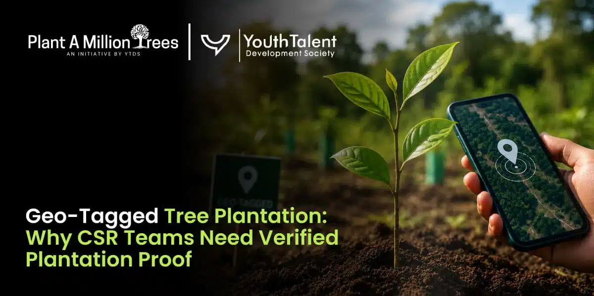
Tree plantation has become one of the most visible CSR initiatives undertaken by companies across India. Every monsoon, organizations invest in plantation drives to support environmental restoration, employee engagement, and ESG commitments. But today’s stakeholders expect more than photographs of employees planting saplings or reports mentioning the number of trees planted.
They want evidence.
Where were the trees planted? Which species were selected? Can the plantation site be verified? Who is responsible for maintaining the saplings after the event? Most importantly, how will the company prove that the plantation continues to create environmental value months or years later?
This is where geo tagged tree plantation has become an essential part of responsible CSR implementation. By combining GPS location tracking, site photographs, plantation records, and maintenance data, organizations can move beyond claims and present verifiable proof of impact.
Whether a company is preparing a CSR tree plantation report, an annual sustainability report, or internal ESG documentation, verified plantation proof builds transparency, accountability, and stakeholder trust. In this guide, we’ll explore why geo-tagging has become a best practice for CSR projects, what information should be included in a geo-tagged plantation report, and how it strengthens long-term tree plantation monitoring.
In simple terms, a geo tagged tree plantation is a plantation project where every site is digitally linked to its exact geographical location using GPS coordinates. Instead of relying only on photographs or plantation certificates, companies create a location-based record that allows anyone involved in the project to verify where the plantation took place.
Think of it as creating a digital identity for the plantation site. Along with the latitude and longitude, the record usually includes photographs, the plantation date, species planted, site details, and supporting documentation. When combined, these elements create a reliable and transparent record of the project.
For CSR teams, geo-tagging is not about adding another administrative task, it is about strengthening credibility. A plantation report backed by verified location data carries much greater value than one that simply states, “5,000 trees planted.”
A well-documented geo-tagged plantation report generally includes:
Many organizations are also integrating geo-tagged records into GIS dashboards, mobile applications, and digital reporting platforms. This allows CSR managers to track multiple plantation sites across different states while maintaining consistent documentation.
The objective is straightforward: create plantation records that can be verified today and monitored in the future.
A plantation drive may receive media attention, generate enthusiastic employee participation, and produce hundreds of photographs. However, a common challenge emerges a few months later when the company begins preparing its sustainability report or responding to stakeholder queries.
Questions such as “Where exactly were the trees planted?” or “How do we know the plantation still exists?” are difficult to answer if the project relies only on event-day documentation.
This is why geo-tagging has become increasingly important for modern CSR programs.
One of the biggest advantages of geo tagged tree plantation is that it introduces accountability into every stage of implementation. When the exact location of each plantation site is documented, companies can revisit the site for survival assessments, maintenance audits, and impact evaluations. Instead of treating plantation as a one-day event, geo-tagging supports a lifecycle approach where planning, execution, monitoring, and reporting remain connected.
Geo-tagging also strengthens relationships with multiple stakeholders.
For CSR teams, it simplifies project management by making it easier to track different plantation locations and verify execution across multiple regions.
For ESG and sustainability teams, verified location data supports annual disclosures with credible evidence instead of relying solely on descriptive narratives.
For management and CSR committees, geo-tagged records demonstrate that allocated CSR funds have been used for measurable environmental outcomes.
For external stakeholders, including investors, auditors, regulators, and community partners, it creates confidence that the reported impact is genuine rather than symbolic.
Many companies also discover that verified documentation makes future projects easier to manage. Historical geo-tagged records provide a benchmark for comparing survival rates, identifying high-performing sites, and improving planning for subsequent plantation drives.
Ultimately, geo-tagging transforms plantation from an activity that is simply reported into one that can be measured, revisited, and continuously improved.
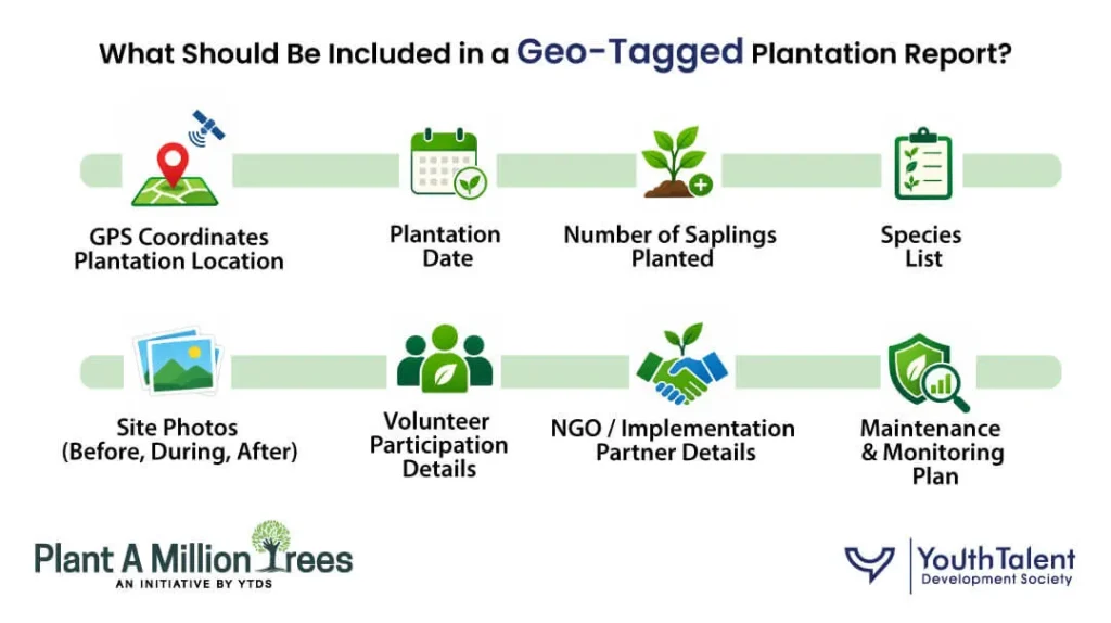
A geo-tagged record becomes valuable only when it captures complete information rather than isolated GPS coordinates. Location data alone cannot explain the environmental impact of a plantation project. It needs to be supported by contextual information that tells the complete story of the initiative.
Many companies discover that the strongest CSR tree plantation report is one that answers the questions stakeholders are most likely to ask before they even ask them.
A comprehensive report should begin with the basics: the exact plantation location, date, and purpose of the project. It should clearly explain whether the initiative focused on biodiversity restoration, urban greening, groundwater recharge, employee volunteering, or another CSR objective.
The report should then provide a detailed species inventory. Instead of mentioning only the total number of saplings, list the native species selected, explain why they were chosen, and indicate how they suit the local ecosystem. This demonstrates that the plantation was planned thoughtfully rather than executed using a generic species mix.
High-quality site photographs are equally important. Ideally, they should include images of the land before plantation, the planting activity itself, and the completed site. These visuals help establish authenticity and provide useful reference points for future monitoring visits.
Volunteer participation should also be documented. Record the number of employees, community members, students, or local residents involved in the activity. For companies that view plantation as an employee engagement initiative, these records contribute valuable insights into participation and outreach.
Implementation details deserve equal attention. Identify the NGO or implementation partner, describe their responsibilities, and explain how maintenance will be managed after plantation day. Many CSR projects succeed or fail not because of planting quality but because long-term care was never clearly assigned.
Finally, every geo-tagged report should include a post-plantation monitoring plan. This section should outline how survival rates will be measured, how often inspections will occur, who will conduct maintenance visits, and how replacement planting will be handled if saplings do not survive.
A report built around these elements does much more than document an event. It becomes a practical management tool that supports tree plantation monitoring, improves CSR documentation, and provides reliable evidence for future ESG reporting.
Almost every CSR plantation drive ends with a group photograph. Employees pose with saplings, banners are displayed, and the images are shared across social media and annual reports. While these photographs capture participation and enthusiasm, they do not necessarily prove environmental impact.
A common mistake many companies make is assuming that event documentation is the same as project documentation. In reality, the two serve very different purposes.
Group photos answer questions like “Who participated?” Geo-tagged proof answers “Where exactly was the plantation carried out, what was planted, and how can it be verified later?”
For example, imagine two companies that each report planting 5,000 saplings. The first company publishes photographs from the event and a press release. The second provides GPS coordinates, geo-tagged site photographs, species lists, maintenance schedules, and six-month survival updates. While both claim the same plantation numbers, the second organization offers far greater credibility because its impact can be independently verified.
A robust geo tagged tree plantation approach also prevents common reporting issues such as duplicate plantation claims, incorrect site references, incomplete documentation, or confusion about species and quantities. It creates a permanent digital record that can be revisited during audits, monitoring visits, or future impact assessments.
For CSR teams, this distinction is becoming increasingly important. Stakeholders no longer evaluate plantation projects based solely on participation or publicity, they expect evidence of execution and long-term stewardship.
A well-executed plantation project generates much more than environmental benefits. It also creates valuable data that supports reporting, governance, and strategic planning.
Today, CSR reports, Business Responsibility and Sustainability Reporting (BRSR), ESG disclosures, and internal board presentations increasingly require measurable outcomes rather than activity summaries. Geo-tagged plantation records help bridge this gap by providing structured, verifiable information.
For CSR teams, location-based documentation demonstrates that projects have been implemented as planned. For sustainability teams, it supports transparent environmental reporting with site-level evidence rather than general statements. Finance and compliance teams also benefit because geo-tagged records strengthen project accountability and make internal reviews easier.
Over time, geo-tagged data becomes even more valuable. Companies can compare survival rates across different locations, evaluate which native species perform best under local conditions, identify recurring maintenance challenges, and refine future plantation strategies based on evidence rather than assumptions.
Many organizations also integrate geo-tagged plantation records into digital dashboards. Instead of reviewing scattered spreadsheets and photographs, managers can visualize plantation locations, maintenance schedules, survival trends, and monitoring visits from a single platform. This improves coordination between CSR teams, implementation partners, and senior management.
Most importantly, geo-tagged reporting demonstrates that the company is committed to measuring outcomes rather than simply reporting activities. That shift, from documenting effort to documenting impact, is what distinguishes mature CSR programs from one-time environmental campaigns.
One of the biggest misconceptions about geo-tagging is that it ends once the plantation event is over. In reality, the initial GPS record is only the starting point.
Many companies discover that the real value of geo-tagging emerges during the months and years that follow.
A plantation site should be revisited periodically to document survival, growth, and maintenance activities. Each monitoring visit can add updated photographs, survival observations, replacement plantation details, irrigation records, and maintenance notes to the existing digital record.
This creates a living history of the project instead of a one-day snapshot.
For example, a six-month monitoring visit may identify areas where grazing damage has affected survival. A one-year assessment may show which native species adapted best to local conditions. A two-year review can demonstrate canopy development, biodiversity improvements, and increasing ecological value.
These longitudinal records strengthen tree plantation monitoring while providing credible evidence for future CSR reports, ESG disclosures, and stakeholder presentations.
Organizations that invest in continuous monitoring also make better management decisions. They can identify high-performing implementation partners, improve species selection, optimize maintenance budgets, and increase survival rates in future projects.
Simply put, plantation proof becomes meaningful only when it evolves into plantation monitoring.
Even well-intentioned plantation projects can lose credibility because of weak documentation. Fortunately, most reporting mistakes are preventable.
One common issue is relying only on group photographs without recording the actual plantation site. While participation is important, photographs alone do not verify implementation.
Another frequent mistake is omitting species information. Reporting only the total number of saplings planted provides little insight into ecological value. Stakeholders increasingly want to know whether native, biodiversity-friendly species were selected and whether they are suitable for the local landscape.
Some organizations also overlook maintenance planning. A report that describes plantation day but says nothing about watering schedules, survival monitoring, or replacement planting leaves important questions unanswered.
Poor documentation is another recurring challenge. Missing GPS coordinates, inconsistent plantation records, incomplete attendance details, and unstructured reports reduce confidence in the project’s authenticity.
Finally, many companies stop reporting after the plantation event. Without survival updates or follow-up monitoring, it becomes difficult to demonstrate long-term environmental outcomes.
The strongest CSR tree plantation report is one that treats documentation as an ongoing process rather than a one-time requirement.
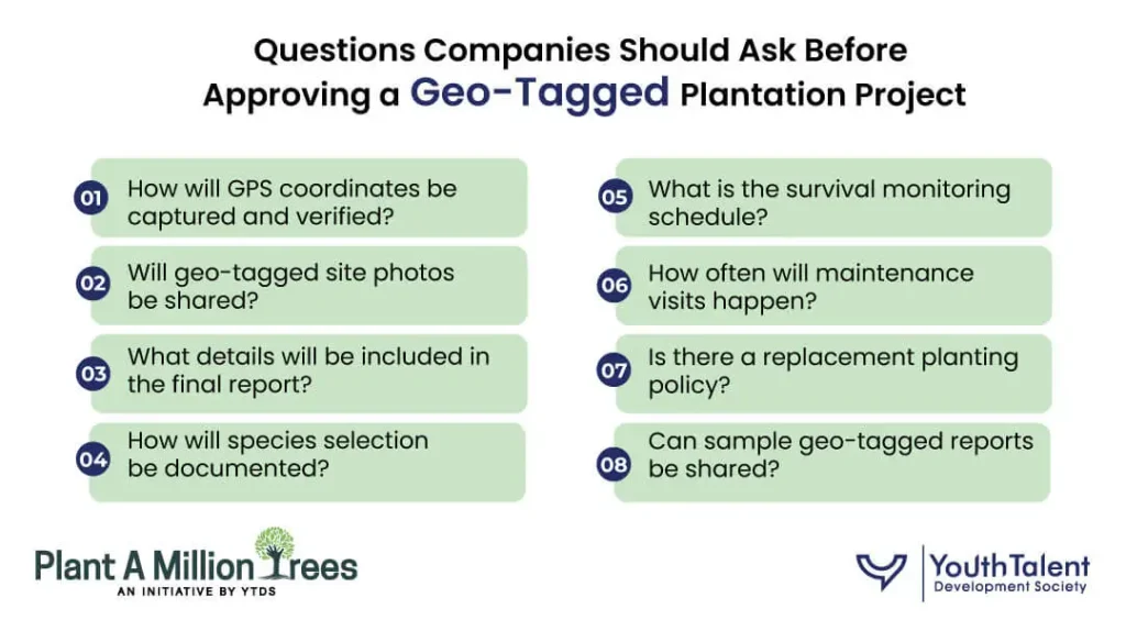
Selecting the right implementation partner is just as important as selecting the right plantation site. Before approving any project, CSR teams should ask practical questions that clarify how transparency and monitoring will be maintained.
Some of the most useful questions include:
Asking these questions early helps companies choose implementation partners who prioritize transparency instead of simply completing plantation events.
For companies investing in long-term environmental initiatives, implementation quality extends well beyond plantation day. Along with planning and execution, reliable documentation and transparent reporting are equally important.
Youth Talent Development Society supports CSR tree plantation projects through structured implementation that emphasizes geo-tagged documentation, verified plantation records, maintenance planning, and impact tracking. Instead of focusing only on plantation numbers, the approach is designed to help organizations build credible records that support internal reporting, ESG disclosures, stakeholder communication, and long-term monitoring.
By integrating planning, execution, employee participation, geo-tagged reporting, and post-plantation care into a single framework, companies can strengthen both environmental outcomes and reporting credibility.
Plan a structured tree plantation project with geo-tagged documentation, maintenance tracking, employee participation and reporting support for your CSR and ESG requirements.
A geo tagged tree plantation is a plantation project where the site is documented using GPS coordinates along with photographs, species information, and supporting records, making the plantation location verifiable.
Geo-tagging provides transparent, location-based evidence that strengthens CSR documentation, improves accountability, and supports ESG reporting with verified plantation proof.
No. Geo-tagging records the plantation site, while monitoring tracks survival, maintenance, and ecological progress over time. Both are essential for demonstrating long-term impact.
A comprehensive report should include GPS coordinates, plantation date, species list, site photographs, volunteer participation, implementation partner details, maintenance plans, and future monitoring schedules.
Yes. Verified location data, structured documentation, and maintenance records simplify internal reviews, third-party audits, and stakeholder verification.
As expectations around CSR accountability continue to grow, companies can no longer rely solely on plantation counts or event photographs to demonstrate environmental impact.
A geo tagged tree plantation transforms a plantation drive into a transparent, verifiable, and measurable project. By combining GPS location tracking, detailed documentation, structured monitoring, and long-term maintenance records, organizations build trust with investors, regulators, employees, and communities alike.
More importantly, geo-tagged reporting shifts the conversation from “How many trees were planted?” to “How many are surviving, growing, and creating measurable environmental value?”
That is the standard modern CSR demands, and the foundation of credible, impact-driven plantation programs.
“How much land do we need for 1,000 trees?” is one of the first practical questions CSR teams ask...
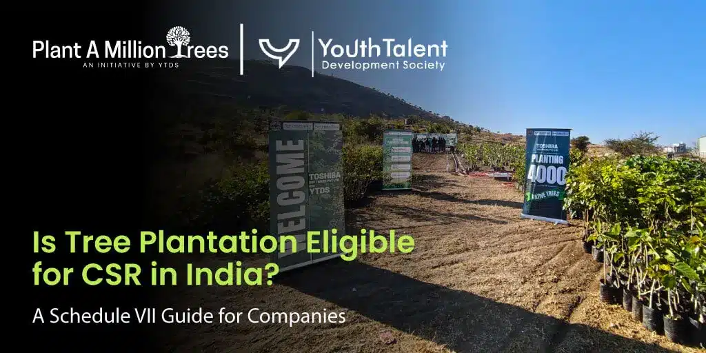
Tree plantation has become an important part of corporate environmental sustainability initiatives in India. Companies are funding plantation drives,...
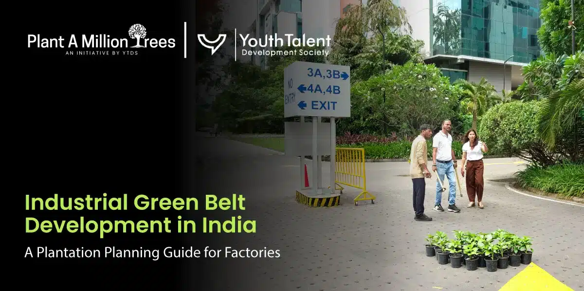
Industrial green spaces are often treated as rows of trees added around a factory boundary. In practice, effective green...